Provence 2018
Part 3 - The Journey Home
Where was I? Oh yes, at the airport saying goodbye to my wife.
She tearfully kissed me goodbye and clung to me like a damp limpet. No, that didn't happen. She was going to give me a hug but my t-shirt was so sweaty that it would have been like squeezing a wet sponge and I would have left an unpleasant puddle on the terminal floor.
Back outside and on the bike I was on my own again with some rough plans of what to do between now and when I was due home six days later.
First stop was a trip to the seaside. I was only about 20k from the coast and it would be silly to come all this way and not visit the med.
I headed South East on D9, which runs along the top of the hills, and went into Sausset-les-Pins which I knew to be a nice little town with some good restaurants overlooking the small harbour and the sea. I was going to have something to eat and send a picture to my son (who was driving to Mongolia) to piss him off. Sadly there was some major construction work going on there so I went back to the D9 and followed it along to where it ends at a little seaside town.


After all the high temperatures, the sea breeze made it just perfect and I had a nice few hours relaxing there before heading up to the hotel near Aix-en-Provence for the night.

Distance for the day: 90 miles
10 Euros they charged me for breakfast! So I ate as much as I could - it might have been 3 helpings, and sat at a table in the shade outside while I planned my route, so quite pleasant really.
Once my gut was stuffed it was time to load up and hit the road again (well, put the tank bag on). I rode in to Aix to see what it was like, thinking that I might find a nice old centre, but all I found was a one way system so set the onboard navigation to "let's get out of here" and got back to enjoying the journey.
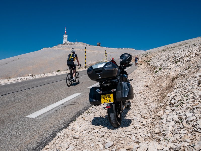
I did a loop northwest towards Avignon and then northeast past Carpentras to Bedoin - ready for my ascent of the big one, "The Beast of Provence", Mont Ventoux.
There were *lots* of cyclists going up the mountain that day, and as many coming down. It’s a very hard climb on a bicycle so the folks going up were grinding their way slowly, and the ones coming down were going for it. Combine that with a twisty, narrow road and the car drivers were stuck, there just wasn’t space to pass safely and they were having to slip their clutches to go slowly enough.
The smell of fried clutch plates hung heavy in the air. Except for me of course, I was around them and enjoying myself (being careful to give the cyclist plenty of room and not go too fast into the blind corners).

As a cyclist also, I stopped to pay my respects at the Tom Simpson memorial.
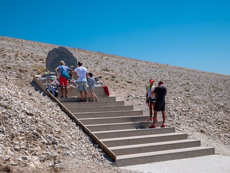
I didn’t actually ride all the way to the top, there’s a one way system for the last bit and it was rammed with cyclists who I felt deserved it. I parked a little way below the summit and walked up the stairs.


Wikipedia has this to say:
“As the name might suggest (venteux means windy in French), it can get windy at the summit, especially with the mistral; wind speeds as high as 320 km/h (200 mph) have been recorded. The wind blows at 90+ km/h (56+ mph) 240 days a year. ” Not that day. There was no wind at all. The temperature was just perfect t-shirt weather)
After enjoying the summit for a while it was time to get rolling again. Pretty much everybody, on two wheels or four, was heading back the way they had come down the South side, but I was going North. For someone like me who has a problem with heights the South side is pretty easy, by the time you get above the trees the gradients are fairly shallow. The North side is steeper and the road has some sections where there’s rather a lot of view.


The rest of the afternoon was nice and relaxed riding through that lovely scenery until eventually I came over a little mountain and ahead was the Vercors Massif.

The last lavender field of the trip was at the foot of the Vercors so I breathed deeply as I was passing, and then rode back up the Col de Rousset. In part one I posted a picture of it from the top. Spectacular as it was coming down, going up was even more so because it snakes across the end and one side of the valley and the end of the valley is almost vertical so as you go up you can see the road clinging to that rock face.
Once I got back through the tunnel at the top I headed for Vassieux, the road stays fairly level but the valley drops away as you go along so it gets quite exciting until the road turns left and goes over the top and drops down the other side onto the plateau. I stopped briefly at the Resistance Cemetery (planning to return the next day) and then went down the Grand Goulet/Petit Goulet and over to Saint Jean where I was staying the night again. After a shower I walked into town to have something to eat. Fortunately I’d taken a little torch because it gets very dark there at night ( I’m a Londoner we haven’t had proper night since the miners strikes caused power cuts in the 70’s)

Distance for the day: 190 miles
I was staying here for two nights which meant that I had the whole of the next day to enjoy the Vercors.
Despite my problem with heights, the Vercors is one of my favourite places. There are no major roads in or out of it, there are at least 6 “balcony” roads, stunning scenery. It’s a wonderful place to be on two wheels, whether human or petrol powered.
After breakfast the next morning I headed up one of my favourite roads, which leads up to the plateau in the background of the picture, and then went up to the Col de Tourniol just to enjoy the view of the other side.


Then back to the crossroads and up the mountain on the other side. The road starts by zig zagging up the side of the mountain and then turns into a winding road, with trees on either side. As you go higher you start to see blue through the trees, but it’s still difficult to know just how high you are. Finally the trees open out a little and ahead there is this short tunnel through the top of the hill.
When you get to the other side of the tunnel the road crosses a natural bridge between the head of two valleys, one on each side of the road - Col de la Bataille.


From there I followed the mountain roads to get to the Resistance Memorial and after visiting went to the Resistance Cemetary on the plateau below.


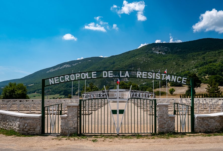
Walking through there and looking at the names and ages was very upsetting. One row looked like it was three generations of the same family, from 59 years to 19 months.

The rest of the day was spent just enjoying the roads and the scenery.


My final stop for the day in Pont-en-Royans
Distance for the day: Google shows 128 miles, I’m not sure if that’s from google maps or the speedo. If it’s from google maps then it’s not accurate.
The next morning I tried to get going as soon as possible as it was going to be a long day. The first stop was down to the supermarket to fill the tank, check the tyre pressures and get some water - 4 0.5l bottles in the tank bag and a couple more in the top box, they were going to be necessary.
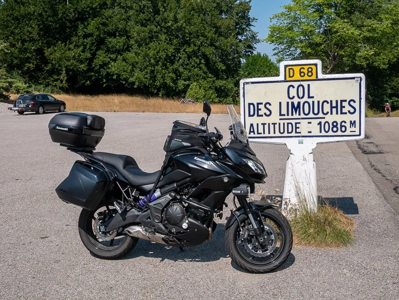
The quick way would have been to go round the base of the mountain to the motorway, but I thought I deserved one more bit of mountain scenery so I headed South up onto the plateau and then along a road that I had been on before which took me over my final col for the trip before a lovely descent to leave the Vercors
I’ll be returning there next year. (who could forsee covid when I wrote that?)
It was a long, long day. 37 degrees, lots of traffic. I later worked out that I’d drunk about 5 litres of water. A couple of times I stopped in the Aires and found somewhere in the shade for a nap to get a break from the heat.
Eventually the sun went down and the temperature got quite pleasant. I was also into northern France by then and the roads were quieter. I was cruising at about 120 kph most of the time, and wondering what the overhead signs were saying. Eventually I remembered to translate it when I was stopped - pollution, slow down 20kph. So that would make the limit 110kph? That obviously can’t apply to me as my bike has a clean air certificate issued by the French Government!
After using the first tank full of fuel that day, I’d filled it up again and when it was about half empty filled it up so that I wouldn’t be sweating about fuel at the end of the day. Good job that I did, by the time I got to my destination for the night I’d done 497 miles. If I’d realised I would have gone round the block a few times.

The next day my arse deserved a break, so I just walked around and relaxed. Like most villages in that part of France there was a WW1 cemetery, it held 54 graves one of whom had been awarded the VC.

Just after the cemetery entrance the road surface turned to cobblestones - it probably looked pretty much as it had when those young men were alive.

The following day, Monday, apart from visiting Cambrai I had a small pilgrimage to make.
My paternal grandfather was one of four brothers but also an identical twin. He’d never spoken about his twin brother to my father so my dad assumed that his uncle had died fairly young.
While researching the family history my brother found that’s not the case, all four brothers served in WW1 (there’s a picture of them together in their uniforms) but Albert, my grandfather’s twin was the only one to be killed. We assume that my grandfather didn’t talk about him because losing an identical twin brother must have been incredibly painful.
At that point the only record of him was his name on the memorial at Arras, so last year on Remembrance Sunday we visited there.
Further research by my brother has revealed the location of his death, the circumstances and the situation in that area at the time. The area where he died was overrun by German forces pretty much immediately afterwards, so it’s likely that his body was one of a number that were buried by the Germans. After the area changed hands again German soldiers were buried in the cemetery.
I rode over there and spent about an hour in the cemetery paying my respects - to all of them.


Distance for the day: 71 miles
Tuesday, the last day of my holiday. I wasn’t in any rush as I had booked the train for the evening, so after breakfast I went to the shops and then had lunch and checked the bike over and packed everything.
Since I’d left home the weather had been hot and sunny every day - but with thunderstorm warnings. I checked the weather apps and on one of them (flowx) I could see big wet clouds were going to come through SE England & NW France later that day.
Later that afternoon I started to hear thunder so I left early and put on waterproofs. Despite seeing lightning I think I probably got to about 30 miles from Calais before I met the rain and the closer I got the heavier the rain got. At Calais I sat in the rain for about an hour in the queue for immigration, and by the time I got to the terminal it was only a few minutes before my train was called.
Back in England it was dry at first but as I came up the motorway the rain started and quickly got very heavy, it might even have been hail at one point. I’d slowed down to about 40 mph and got terrified by the cars overtaking at about 70, leaving trails of blinding spray for hundreds of metres behind them.
By the time I got to the M25 the rain had stopped, the roads were dry and it was warm. At Leatherhead I turned off and cut across to the A3 and pulled up outside home just before midnight.

Distance for the day: 217 miles.
Total distance: 2556 miles